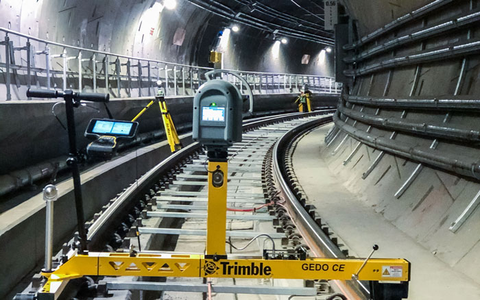
Towill offers a wide array of surveying and mapping services to the tunneling and underground construction community, including project-wide geodetic control networks, control and alignment verification for Tunnel Boring Machines (TBMs), deformation monitoring, control transfer through vertical shafts of tunnels, and tunnel alignment verification using precision survey techniques and gyro-azimuth determinations.
| |
- 3D digital terrain models
- 3D LiDAR tunnel scanning
- Aerial orthophotography
- Aerial mapping
- Airborne LiDAR
- Construction support
- Detailed topographic field surveys
- Final tunnel liner and pipe as-builts
- GIS development and data integration
- Gyro-azimuth determinations and heading checks
- Primary geodetic survey control
|
|
- Roadway excavation and TBM guidance support
- Secondary and photo survey control
- Surface deformation monitoring methodologies
- Survey methodology and procedures consultation
- Terrestrial LiDAR
- Trackwork measurement
- Tunnel improvements
- Underground construction surveys
- Utility location and identification
- Utility pothole coordination
- Vertical shaft transfers
|
|