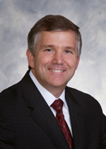
Ken Meme, a Certified Photogrammetrist with over 30 years of experience, joined Towill immediately following the completion of his bachelor’s degree in Surveying and Photogrammetry, with a dual (simultaneous) major in Geography from California State University, Fresno. Ken is Towill’s Chairman of the Board, with overall direction of our business. He plans, develops, and establishes policies and objectives of the organization in accordance with board directives. Ken manages the efforts of senior executives and members of the board and works with them to develop current and long-range objectives, policies, and procedures for Towill. His experience includes management and principal oversight of hundreds of projects in the federal, state, local, and private sectors.
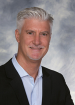
Brian Young currently serves as Towill’s Vice President, Mapping and GIS. Brian manages the company’s aerial surveying division with emphasis on photogrammetry and airborne LiDAR services. He brings to Towill over three decades of technical and managerial experience in the fields of geographic information systems (GIS) and photogrammetric mapping; he possesses a strong depth of expertise in multiple aspects of geospatial solutions, including project design, geospatial data acquisition strategies, providing guidance to technical staff, and client relations. Brian holds a B.A. in Physical Geography from the University of California, Berkeley and an M.S. from Oregon State University in Applied Geography. In addition to his technical responsibilities, Brian also serves as Towill’s client relations manager for several key public agency customers and large A/E firms.

Dawn Antonucci currently serves as Towill’s Vice President and Director of Marketing and Business Development. In this role, Dawn is responsible for managing corporate marketing and communications, including the development of marketing plans, strategies, objectives, policies, and work procedures in accordance with Towill’s corporate objectives. Dawn has been with the company for over 15 years and brings to Towill over two decades of experience in the geomatics, engineering, and construction management profession. Dawn is Past President of Society of American Engineers (SAME) San Francisco Post, Past President of American Council of Engineering Companies (ACEC) California Bay Bridge Chapter, and Past President of Construction Management Association of America’s (CMAA) Northern California Chapter.
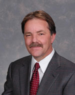
Trevor Greening currently serves as Towill’s Vice President and is responsible for the management of numerous technical large-scale geodetic, precision engineering surveying, and mapping projects. He brings to Towill four decades of experience in a wide range of survey and mapping disciplines. As an innovator in the industry, Trevor utilized GPS technology to establish the geodetic control system for Boston’s Third Harbor Tunnel. He has extensive underground construction surveying experience involving at least thirty tunneling projects, while his international experience spans more than a dozen countries on four continents. He possesses an M.S. in Surveying Engineering from the University of New Brunswick, Canada and a B.S. in Surveying Engineering from the University of Natal, South Africa.

Frank Borges has over two decades of experience and is a Professional Land Surveyor licensed in the states of Arizona, California, Nevada, and Oregon. He manages Towill’s Northern California survey offices and has served as President of the local chapters of ACEC California and the California Land Surveyors’ Association. Frank has performed and supervised projects involving aeronautical surveys, boundary surveys, topographic base maps, geodetic survey control, aerial mapping, monitoring surveys, construction staking, hydrographic surveying, and LiDAR scanning. He has a B.S. in Surveying Engineering from California State University, Fresno.
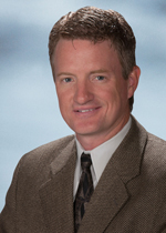
Keith Kirkby has 22 years of geodetic engineering experience and is a Professional Engineer licensed in Colorado and Canada. He has a diverse array of proficiencies across the geomatics sciences with an emphasis on remote sensing and very-high-precision field and industrial surveys. During the last decade, Keith has led Towill’s airborne LiDAR acquisition group and been involved in several high-profile industrial metrology projects. Keith has a B.S. in Survey Engineering from the University of Calgary; an Aviation Diploma from Mount Royal College, Calgary; and is an FAA-licensed pilot.
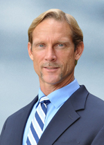
Jake Kruger is a Professional Land Surveyor licensed in California and Nevada, with 25 years of land surveying experience. He manages Towill’s San Diego office and is a project manager on multiple on-call contracts for municipal clients and public utilities, overseeing extensive overhead transmission and distribution survey projects including LiDAR and photogrammetric mapping. Jake is Towill’s PLS-CADD technical lead for training and review of survey deliverables in this software. His education includes undergraduate studies with an emphasis on land surveying and mathematics at the University of North Dakota, Grand Forks.

John T. May has 21 years of land surveying experience. He has spent his career in the private sector, providing a wide range of land surveying and mapping services to local agency clients for capital improvement projects, assisting in the development and implementation of map checking procedures for three local counties, and participating in multiple professional organizations. John’s success comes from providing Towill’s Northern California clients with advanced technologies, embracing GIS, LiDAR, gyro-theodolites, and related deliverables. He has a B.A. in History from San Jose State University and was also an Adjunct Professor there, teaching Introduction to Geomatics for civil engineering majors.

George Maalouli has mapping experience using aerial, satellite, and LiDAR imagery throughout the United States and abroad, since 1989. His experience includes virtually every aspect of aerial photogrammetric and LiDAR mapping, such as flight and project planning, development and implementation of rigorous QA/QC procedures, custom software development, project and personnel management, technical oversight and consulting, acquisition and processing of aerial photography, advanced photogrammetry computations, and Geographic Information Systems. George has an MSc. in Integrated GeoInformation Production and Multi-Sensor Triangulation, and a Post-Graduate Diploma in Production Photogrammetry, from the International Institute of Aerospace Survey and Earth Sciences (ITC) at the University of Twente, Enschede, The Netherlands, as well as a Technologist Diploma in Plane Surveying and Mapping from Algonquin College, Ottawa, Canada.
